
Play Here

Horseback Riding Trails
Equine Trail System
The Pennyrile State Forest equine trails are very scenic, with many sheer sandstone bluffs and rock-bottom streams. Most trails are reasonably safe, but may be challenging for the beginning rider. The trail system is marked with plastic squares with points up and side to side. Each trail is marked with both directions with a different color for each of the three major trails. Please use good trail manners and remember, Pack it in – Pack it Out. Always be alert for trail hazards including wildlife.
Points of Interest SPRING BLUFF: The trail runs parallel to the bluff line for more than 1,000 feet and the shelter cave is quite large. Also a site of a dripping spring. TWO CUT-OFF TRAILS: Both will shorten the ride. One cut-off trial will take you past the Hamby Home Place and Family Cemetery, which dates to the 1850s. Half of the trail is single track and very scenic.
Orange Trail Loop This trail has the most points of interest and a few challenging areas. There are also quite a few gravel roads, so be aware of traffic. The Orange Loop is about 8 miles long and takes about 3.5 hours to ride at a slow pace. The trail crosses Clifty Creek which is the main feeder for Pennyrile Lake and therefore, Lake Beshear. Clifty Creek is very scenic, with many rock-bottom crossings, which could be hazardous.
Blue Trail Loop This trail is the shortest of the three marked trails and is 4.5 miles long. It can be ridden in about 2 hours at a slow to medium pace. The terrain is gently rolling to moderate hills and can be ridden by those with medium riding skills. The trail is mostly logging access roads, with some single-track trails and a little gravel road.
Yellow Trail Loop This trail is nearly 6.9 miles long and takes about 3 hours to ride the complete loop, if you ride at a slow to medium pace. There are a couple of cut-across trails that will shorten the distance and riding time. The terrain is gently rolling to moderate slopes and can be ridden by those with low to medium riding skills. The trail is mostly two-track dirt roads with some single-track areas. Caution should be used at the two highway crossings because of slick pavement and traffic hazards. The Water Shed Lake is a good mid-point landmark and a good spot to rest.

Bike Riding Trails
Regional Bike Trails
Dawson Springs, Kentucky makes an excellent base for road cycling in the Pennyrile region. Hundreds of miles of good pavement on sparsely traveled and scenic roads provide an excellent location for a short, leisurely spin to a challenging century ride in the hills.
Mountain Bike Trails
In nearby Pennyrile Forest, there are 10 miles of challenging mountain bike trails along scenic creeks and bluffs. Across from the trail-head and campground, a mountain bike skills area will be built. The 13-mile Pennyrile Nature Trail connects these trails to Dawson Springs.
Upper White Loop: This trail is accessed from the new trailhead. You can go either direction. Heading downhill (east) from the trailhead is the quickest way to access the Lower White Loop. The Upper, traveling north, parallels HWY 398, and is good for beginners (until the wooden bridge, where the downhill starts.) After that, it’s a fast-flowing downhill to some tricky creek crossings just past a cascade, and then you parallel a scenic bluff. It continues at an intermediate level with a steep climb, followed by rollers with some rocky drainage crossings. Continue uphill at the junction with the Lower to reach the trailhead.
Lower White Loop: Access from the Upper as described above, usually ridden turning right at the junction. This is probably the least technical loop overall. Just after leaving the Upper, you parallel a large creek, with some easy rollers to follow. As it loops back north on the other side of the same creek, there are 2 creek crossings that can be ridden, but if the water is too high, they can be crossed by walking just a bit off trail. More rollers follow, with a major creek crossing that all except experts will want to walk across. Just after that, it connects back with the Upper White, where you can go back to the trailhead, or continue along the Upper.
Blue Trail: This trail can be accessed from the Upper White at the Blue Connector. Going right (east,) you soon come to the junction with the Red, and continuing on the Blue is a steep climb. At the top of this is the Yellow Trail junction. Continuing on the Blue is mostly beginner terrain, with some easy rollers and a few rocks here and there. It continues almost to HWY 398, where the old trailhead was located. Just after that, the trail is more intermediate with some harder climbs and descents, and some rocky creek crossings that can easily be walked for beginners. You can take the connector back to the White Loop to the trailhead, or continue on to the Red and Yellow trails.
Red Trail: This trail has some of the most technical sections in the area. Most of these are located on the southern section of the trail, accessed by taking a right at the first junction. This can be bypassed by taking the Blue uphill as described above, taking the Red Trail there and continuing past the first Yellow junction to the more southerly junction with the Yellow. This section of the Red is mostly intermediate, passing through some old stands of hardwood and some very nice single-track. The technical section of the Red is very scenic, passing just below a beautiful bluff line, and just edging a large creek. There are some very rocky sections and roots, which makes it a very fun section for upper intermediate riders.
Yellow Trail: Mostly intermediate, this trail also has some sections of older trail through hard woods, which is great single-track. Some sections can be ridden fast, curving through the trees. If accessing from the Red at the southern junction, you pass through a small briar thicket, then quickly reach a wide creek crossing which is usually easy, but at high water can be walked. Just after there is a moderate climb into some really nice older trail. This continues for a while, until you come to a few rocky areas and a tricky rocky drainage crossing. After that, you come to a wide area of trail with lots of pines suffering from ice storm damage. There are frequent downed trees there, and sometimes some drainage issues. You will cross a metal bridge across the creek, and the trail narrows into a briar thicket, which can sometimes be a problem, but this section is short. It then connects back to the Red Trail.

Fishing, Boating & Canoeing
Tradewater River Access Points
Plan your fishing trip and improve your success with the KY Department of Fish and Wildlife Resources fishing forecast. Click here to view.
Blueway Trails
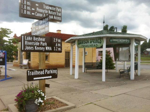
Dawson Spring, Kentucky offers several opportunities for canoeing and Kayaking. Paddle down Tradewater river one of the 8 Largest Rivers in Kentucky. Discover folklore of historic sites like The Devils Dinning Table, Lovers Leap, and the Chalk Clift as you arrive at the all wood baseball stadium at Riverside Park and the Historic Mill Dam. Explore of the beautiful Lake Beshear an 800 acre lake with miles and miles of shoreline. Rent a canoe or Kayak from Pennyrile State Resort Park for a leisurely day with your family or friends.
The Tradewater River is one of the eight major rivers of Kentucky. The eighty mile lazy river finds its humble beginnings in Christian County and it flows in a Northwesterly direction around Dawson Springs through the heart of the western portions of the Dripping Springs Escarpment topographical region until it finally reaches the Ohio River.
Lake Beshear
Lake Beshear is located in the center of the Pennyrile Forest State Park approximately 4 miles south of Dawson Springs off State Highway 672. This lake lies in Caldwell and Christian counties. Lake Beshear, owned by the Kentucky Department of Fish and Wildlife Resources, was built in 1962 and opened to public fishing in 1964. Boating access is provided at Redden’s Boat Ramp for a fee. Skiing is allowed only in the Piney Creek portion of the lake.
THE FISHERY
Species present in the lake include largemouth bass, white crappie, bluegill, green sunfish, longear sunfish, channel catfish and blue catfish.
PHYSICAL DATA
Surface elevation (ft msl) …………………. 410
Surface acres ……………………………….. 784
Miles of shoreline ………………………….. 23.6
Maximum depth (ft) ………………………….. 35
Mean depth (ft) ………………………………. 10
Hiking
Pennyrile Nature Trail: Northern Portion
Presently, there is a portion of the Pennyrile Nature Trail beginning at the Tradewater Park/PNT Trailhead just off of Hwy 109 that is clear to the “No Outlet Road”. When approaching the “No Outlet Road” some choose to turn left on the “No Outlet Road”, continue and cross Hwy. 109, and continue down the “Old Hospital Rd. to the point of beginning, creating a 4.2 mile walking and mountain biking loop. Should you choose this route, please remember to “Stop, Look, and Listen” for vehicular traffic
Dawson Springs Museum & Art Center
Dawson Springs Museum & Art Center
The Dawson Springs Museum and Art Center was established in 1986 in the old Commercial Bank of Dawson, built in 1907. The museum was established to store the history of the city and the surrounding areas from the 1900s relating to their medicinal waters. People came from far and wide, by train and wagon, to get baths and partake of Dawson Springs’ healing waters. At one time there were 22 rooming houses and several large hotels built to accommodate these visitors. Today, all of that history can be found at the museum.
More recently, the museum serves as an educational facility, with exhibits showing the work of local and visiting artists. Junior and senior high school students from the local high school art departments, with the help of their teacher, Mrs. Cindy Crider, also have a yearly art exhibit. Pictures of a local race car track and drivers from the 1950s are also on exhibit. We house the largest collection of Japanese woodblock prints and kimonos in the United States from the collector, Mr. Claude Holeman.
The Museum also hosts the Mack Sisk collection of pictures of the early days of Dawson Springs, as well as a collection of pictures and general information from the Outwood Hospital, a federal TB facility for soldiers from WWI.
We have a reunion each year for the 50-year graduating class.
We also host receptions for the visiting artists and authors as well as host book signings
We have something for everyone, so bring your children and come spend the afternoon with us, you may just be pleasantly surprised at what you find
Admission is free.
Sylvia Thomas
Executive Director